

Norris Peak
- Ashley
- Feb 5, 2019
- 3 min read

Updated: Mar 15, 2020

At nearly 5,000 feet in elevation, Norris Peak isn't the tallest of the Black Hills' peaks but it is a fun and challenging hike. It's an uphill climb almost the entire way, and getting to the top requires navigating the far western end of the Shanks Quarry Trail System.


None of the trails we encountered were marked in a traditional sense, so finding your way up the mountain can be confusing. Take the guesswork out of navigating by studying the local topography (or various trail maps) before you go. Knowing the location of Norris Peak relative to where we were enabled us to pick the correct paths along the way.


The initial pull-off for the trail is an unmarked dirt road located just north of Johnson Siding on Norris Peak Road. Start by heading west from Rapid City, South Dakota, on Highway 44 and take a right onto Norris Peak Road. After a short distance the unmarked road (referred to as Norris Peak Spur on some maps) will be on your right (if you reach Geary Boulevard you've gone too far). There's no parking area, just several spots to pull off and park along the dirt road.


After a short distance, a footpath marked only by a large boulder departs to the left and heads off into the woods. This otherwise unmarked trail is known as Willie's Run. Its steep and rocky ascent is probably the most challenging stretch of the hike.
This was a fairly strenuous climb up the mountain, but not too difficult for the dogs -they very much enjoyed the adventure. Older or smaller dogs may find the terrain challenging.

Several other trails shoot off along the way. One of which, known as Bone Collector, was marked with bones tied noticeably to a tree. Past that and through an open fence, the trail runs into Log Porch Road (another unmarked dirt road). Take a left along this mostly flat and even portion of the trek.


After a short walk another footpath marked with a rock cairn heads off to the left. This last stretch of the trail, known as Norris Peak Down Hill, leads the rest of the way up the mountain. This is another steep climb, but not nearly as much as Willie's Run.
Upon nearing the top of the hill the trail winds under exposed rock faces. It then turns and runs behind the cliffs, following them to the summit.

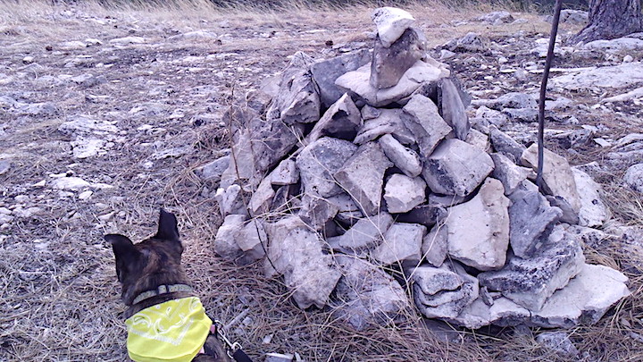


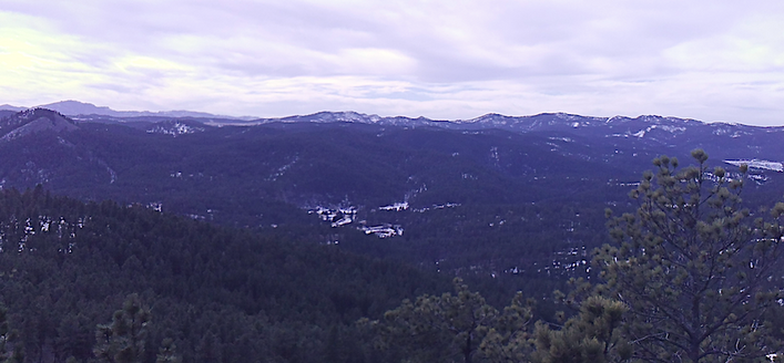
Views of the surrounding mountains made up beautiful vistas at the top. The foundations of an old fire tower and cabin remained in place. A rock cairn marked the actual summit of the hill. Another trail continued down the backside of the mountain, leading further into the Shanks Quarry Trail System.
There were plenty of nice places to sit and enjoy a rest while taking in the scenery. It was a bit windy during our February trip, making it difficult for the girls to enjoy their break for too long. After exploring all there was to see atop the mountain, the dogs were ready to keep moving and head back down out of the wind.


The trails were in decent condition for February; they ranged from dry and rocky to icy to snow covered. This hike was fun but fairly demanding and is definitely for those that like a small challenge. The trek up the hill is less than 2 miles but it's still a good bit of exercise. The dogs enjoyed the hike and loved spotting deer and squirrels along the way. Due to the strenuous nature of the initial stretch we ended up taking more water breaks than we usually do, so we recommend bringing along extra.
We saw the tracks of those who visited before us but didn't run into anyone else on the trails that day. Maggie especially enjoyed the solitude and took pause to roll in every snowbank. The trip back down went fairly quickly, although the steep parts were tedious here and there. Everybody had a good time enjoying the adventure through the woods and up the mountain. We recommend this for cooler days; it was a great way to spend a winter afternoon.


Comments